background

Saturday, October 24, 2015

Dodong's Aftermath


It was all over the radio and the television. 
Typhoon Dodong, with an international name "Noul," is coming to visit Batanes. 
It wasn't a super-typhoon, but it brought heavy rains and strong whistling winds. 
Good thing that it didn't smash the province.

Sleeping during the night of the typhoon was a challenge. 
It was frightening. 
We were baffled by what the storm can do.  
The branches hit the windows, I thought it's going to break ours, because of the powerful wind.

Friday, October 16, 2015

Fiesta in Uyugan

A few days ago, when we visited the town of Uyugan, there were kids in the plaza
who invited us to join them in their festivity. 
I thought they were just making fun of us as they were facetious,
 until one of the elderlies expressed their enthusiasm to have us, tourists, celebrate with them. 
We only bid "ok, we will try.." since we didn't know what's installed for us on that day. 

The day came and we didn't have anything to do so 
we opted to come and experience their fiesta. 

The celebration commenced with the Holy Eucharist 
which was initiated by the Most Rev Bishop Camilo Gregorio.  


Sabtang: Chamantad Cove and Tinyan Viewpoint

We boarded the truck and headed to Chamantad Cove. 
We were welcomed by a stone arch situated in the middle of the road. 
Beside the arch are stalls where fresh coconut juice are sold. 
Instant refreshment from the scorching heat of the sun. Yey!


dried flying fish..they're very delectable! 
Chamantad Viewpoint is considered as one of the highest point in Sabtang, 
which gives you a view of the Pacific Ocean and resembles a scenic spot same that of the rolling hills in Batan.  

SAbtang : Savidug Village

We started our trip by traversing to Savidug town.
The road was a little bumpy.  Had their fair share of ongoing road constructions, 
but we didn't feel it much as we were in a truck. 


The journey around gave us splendid view of the oceans. 
Totally picture worthy. 
Good thing that we sit beside the driver  
and we had the most wonderful view of the what's ahead of us. 


Our first halt was a tour around the traditional village of Savidug. 


It housed the well-preserved stone houses of the Ivatan, primarily made from lime stones and cogon grass roofs which are replaced after 30 years.  

Sabtang: Chavayan Village

We passed a narrow road along the coast with cliffs, 
overlooking the turquoise sea water. 
We also witnessed the impressive structures of the hills and mountains 
as we traversed going to our next destination, the Chavayan Village. 


At the entrance of the village is where the Sabtang Weaver's Association is located. 
It is a group of local women who weave "vakul"  and "kanayi," gears that is made up of dried date palm leaves, 
which protects them from wind, rain and sun when they're out in the field.


The woven gears can be rented for a fee and have your photos taken wearing it. 
We did this when we were in Marlboro Hills in Batan. 


Sabtang: Morong Beach, Mayahaw Arch and Nakabuang Cave

Our ultimate stop during our trip is in Barangay Malakdang. 
It is where we had our late lunch
and where the Morong Beach is located. 


We were sooo hungry that I was able to take a photo of only one dish. :( 
(And besides, I was a bit shy to take photos of the food as we were with our fellow tour mates.) 


Soon after our sumptuous lunch, we went to check out the Morong Beach, 
which is a long stretch of white sand beach with a rock formation
commonly known as Mayahaw Arch. 

Sabtang : Registration at the Tourism Center

Before our tour starts, 
we popped in their Tourism Center, 
a small place where tourists had to come over to register and pay an environmental fee of P200. 


The queue was quite long.  
We were more than 3 groups at that time. 
We were offered tea, a local tea called tubha, and it was quite delectable. (not my type though)
Looking around, I got entertained by their lovely masterpieces hanging in their walls. 
And I took some photos of them. 


Soon after the registration, 
while waiting for the rest of the group to finish, 
we just took some photos around the area. 
(BTW, this is our first time actually to join in a group because 
I've read good reviews about them and so we commingled with them but I got disappointed.
I won't elaborate much as to why..let's just enjoy the island, ok?) 


Later on, we gathered around and listened. 
One of the guides explained to us our itineraries and our destinations. 
I could smell the fun and I'm getting excited. 


Let's go!!! 

Thursday, October 15, 2015

Sabtang Tour: Departure and Arrival

Our Batanes trip wouldn't be complete if we will not experience the faluwas, rough waters of the Pacific Ocean and South China Sea and Sabtang island.
So on our third day, Sabtang is our destination.
It is one of the inhabited islands in Batanes apart from Itbayat and Batan.
To get there, one has to cross the island using a faluwa, a boat designed merely for the waves of Batanes, which is the only means of transportation
going to the island
The said boat has no "katig" or outriggers as this will only be crashed by the waves.


From our home-stay, we traveled for about 30 minutes and halted at Ivana Port.
Many people were already waiting when we arrived.  
We thought we were already late but nah!! 
They were still organizing the things that will be unloaded and loaded in the faluwas.  
Meanwhile, we signed in the manifesto and secured a vest.  


Strolling around the port, we've noticed a lot of water breakers.
It broke the treacherous waters of Balintang Channel,
the area where Pacific meets the West Philippine Sea.
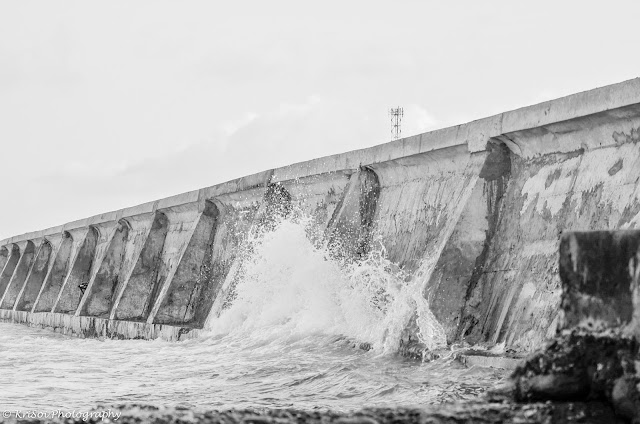

a splash of water 
The ride to the island took us about 45 minutes.
Good thing that the waves weren't that rough and frightening
otherwise I will really be seasick.
 I clung to my boyfriend (opportunity..haha) though
when I could feel the boat glides to the water. 


I could feel the excitement within me as we were approaching the island. 
The scenery is just jaw-dropping. 
It's amazing to see the lush green hills,
 unusual structures of the boats, buildings, and vehicles. 


When we were about to alight the boat, 
on my right side, I spotted the Sabtang lightouse, took a photo of it
while the rest were wait for their turn to get off the boat. 


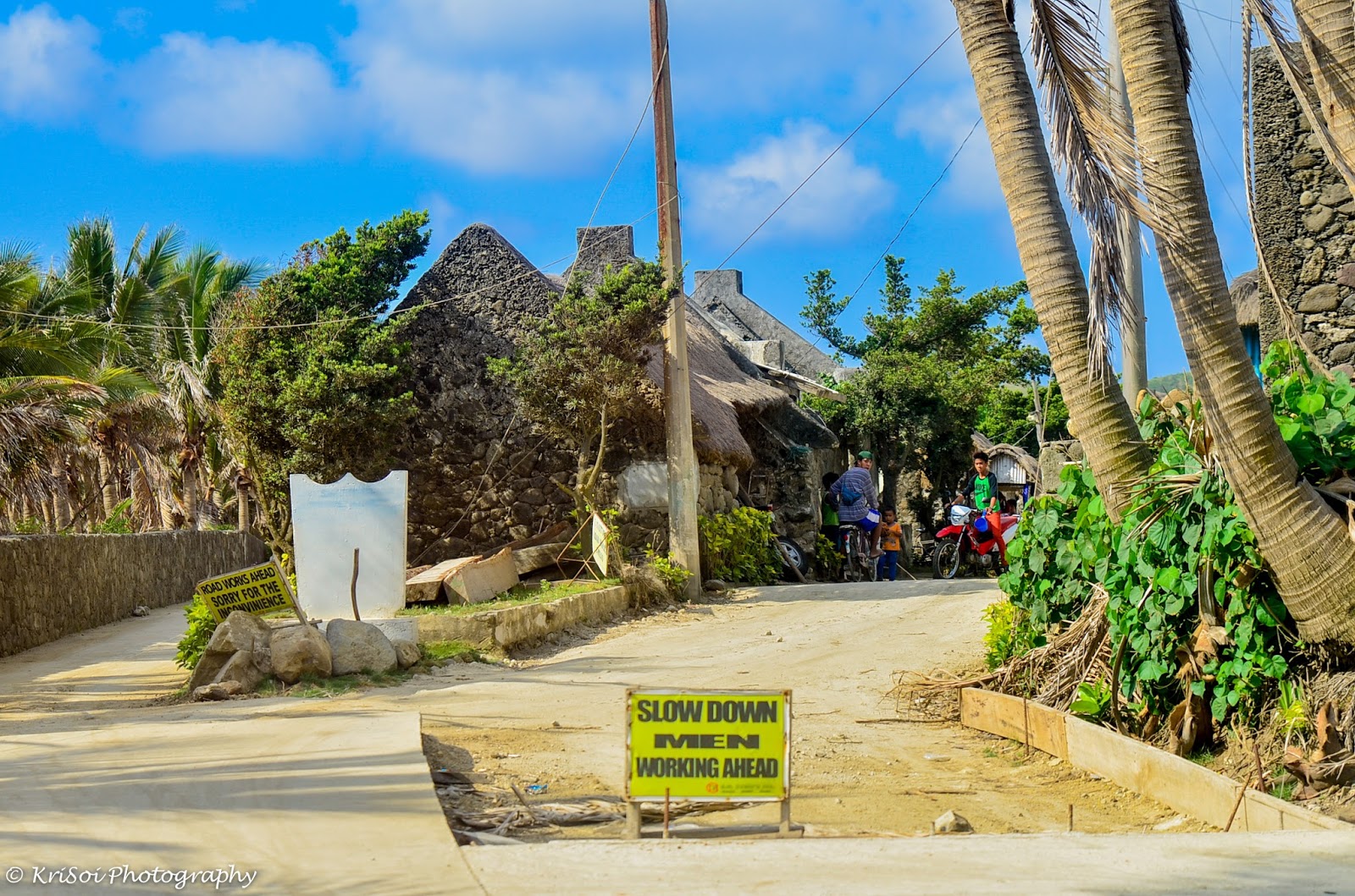
The first step I had in the island brought thrills inside me. 
Thrills of excitement and curiosity of what's installed for us. 
Then I did a little survey around me. 
I noticed this unique multicab pick-up where they had the cogon roof stuffed in. 
Amazing right?  I thought, it's just their houses and motorcycles.
But no! It serves a lot of purpose. 


Hopping in our truck, we headed to the Tourism Center of the island. 

Friday, October 2, 2015

North Batan: Radar Station

Just a few minutes away from the chapel is the Tukon Radar Station.
In Ivatan terms, "tukon" means hills, "radar" means lightouse. 

the view where Mt. Iraya is covered by the clouds
The spot gives you a perfect 360 degree view of Batan. 
As per Wikipilipinas, you'll see the Pacific Ocean on your east side, 
South China Sea on your west, 
Mount Iraya on your north, 
And the rolling hills on your south. 
Wonderful isn't it? 


the wonderful hedgerows 
As per history, 
the Radar Tukon used to be a lighthouse and was used as US weather station.
Now, it merely serves as primal weather station of Basco. 


the golf ball-like weather station


The cow is also up for some snapshots!! hihi!